May Queen Campground
Key facts
- Fee
- Not recorded
Water and dump stations nearby
- 27 mi from May Queen Campground, in a straight lineDirections to Water point near Edwards in Google Maps (opens in a new tab)
- 27 mi from May Queen Campground, in a straight lineDirections to Service point near Edwards in Google Maps (opens in a new tab)
Straight-line distance from May Queen Campground. From OpenStreetMap: "fee not recorded" means no fee is tagged, not that it's free.
Recreation.gov
Book May Queen on Recreation.gov
May Queen Campground is located at the far western end of Turquoise Lake in a shaded lodgepole pine forest. Conveniently perched near the Charles Boustead Memorial Tunnel, May Queen offers easy access to boating, fishing and hiking. Incredible views of the Holy Cross and Mount Massive Wildernesses can be seen from…
- Sites
- 13
- Check-in / out
- 14:00 / 12:00
Book on Recreation.gov (opens in a new tab)Full details
Data: Recreation.gov (RIDB), provided by federal agencies, updated October 13, 2026. Not endorsed by Recreation.gov or the U.S. Government.
Services & facilities
- Drinking waterNot recorded
- Waste disposalNot recorded
- ElectricityNot recorded
- ToiletsNot recorded
- ShowersNot recorded
- Wi-FiNot recorded
- Dogs allowedNot recorded
- Wheelchair accessNot recorded
- Tents allowedYes
- Caravans allowedYes
"Not recorded" means OpenStreetMap has no tag for it yet, not that it's missing.
Prices & opening
No fee information is recorded. Opening hours are not recorded.
Getting there (GPS, access, height)
GPS coordinates
39.27844, -106.43339
Google Maps (opens in a new tab)Apple Maps (opens in a new tab)Waze (opens in a new tab)
No height limit recorded. Check access and signage on arrival.
Reviews & travellers' photos
No reviews yet. Stayed at May Queen Campground? Be the first to tell other travellers what it's like.
Write a reviewAdd photos or video
Reviews, photos and videos come from travellers with a free account. Each one is checked by a person before it's published; see our content policy.
Other places nearby
More in Leadville NorthWithin 25 km. The nearest water and dump station are listed above.
- Campsite near Leadville North
Campground · Leadville North6.9 km from May Queen Campground - Baby Doe Campground
Campground · Leadville North7.0 km from May Queen Campground - Molly Brown Campground
Campground · Leadville North7.1 km from May Queen Campground - Father Dyer Campground
Campground · Leadville North7.1 km from May Queen Campground - Silver Dollar Campground
Campground · Leadville North7.3 km from May Queen Campground - Sugar Loafin' RV Park
Campground · Leadville North7.6 km from May Queen Campground
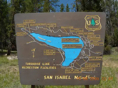
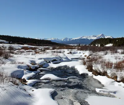
Photo credits for thumbnails on this page (2)
- Nearby: Turquoise Lake Leadville Colorado · 1.0 km away: Photo: SFC H / CC BY 3.0, via Wikimedia Commons
- Nearby: Tennessee Creek · 0.9 km away: Photo: Jeffrey Beall / CC BY 3.0, via Wikimedia Commons

