Drinking water tap for motorhomes near Hoole, Cheshire West and Chester
At a glance
This water tap is 0.4 mi (700 m) south-east of Hoole centre, in Cheshire West and Chester. It is free to use. The record lists opening hours 24/7. The next water tap is 1.2 mi (2.0 km) south-east. The nearest service point with waste disposal is 8.3 mi (13 km) south-west.
What's recorded here
- Drinking water
- Yes
- Fee
- Free
- Opening hours
- 24/7
Fresh water and waste disposal nearby
- 8.3 mi (13 km) from this water tap, in a straight lineDirections to Service point near Gresford in Google Maps (opens in a new tab)
Straight-line distance from this water tap. "Fee not recorded" doesn't mean it's free.
The 5 nearest other drinking water taps
- Water point near Chester
Water point · Chester, Cheshire West and Chester · Free
1.2 mi (2.0 km) south-east of this water tap, in a straight lineDirections to Water point near Chester in Google Maps (opens in a new tab) - Water point near Hawarden
Water point · Hawarden, County of Flintshire
6.2 mi (10 km) west of this water tap, in a straight lineDirections to Water point near Hawarden in Google Maps (opens in a new tab) · - Water point near Hawarden
Water point · Hawarden, County of Flintshire
6.3 mi (10 km) west of this water tap, in a straight lineDirections to Water point near Hawarden in Google Maps (opens in a new tab) · - Water point near Hawarden
Water point · Hawarden, County of Flintshire
6.3 mi (10 km) west of this water tap, in a straight lineDirections to Water point near Hawarden in Google Maps (opens in a new tab) - Hurleston Services Water Point
Water point · Nantwich, Cheshire East
14 mi (23 km) south-east of this water tap, in a straight lineDirections to Hurleston Services Water Point in Google Maps (opens in a new tab)
Straight-line distance and direction from this water tap.
Getting there (GPS, access, height)
GPS coordinates
53.19387, -2.87158
Google Maps (opens in a new tab)Apple Maps (opens in a new tab)Waze (opens in a new tab)
Check access and signage on arrival.
Last reports
No reports yet. Were you here?
Thanks for your report. Anything to add? (optional)
Reports come from travellers and may be out of date. Check on site.
Reviews & travellers' photos
No reviews yet. Stayed at Water point near Hoole? Be the first to tell other travellers what it's like.
Stayed here? Rate it
Write a reviewAdd photos or video
Reviews, photos and videos come from travellers with a free account. See our content policy.
Other places nearby
More in HooleWithin 16 mi (25 km). The nearest water and waste disposal are listed above.
- Belle Vue Farm CAMC CL
Campsite · Guilden SuttonWastePower1.5 mi (2.5 km) from this water tap - NetherwoodTouring Site
Campsite · WavertonPower2.1 mi (3.4 km) from this water tap - Birch Bank Farm Camp Site
Campsite · Guilden Sutton2.3 mi (3.7 km) from this water tap - Fir Trees Holiday Park
Campsite · Blacon2.8 mi (4.5 km) from this water tap - Beech Farm Caravan Site
Campsite · Mickle Trafford3.0 mi (4.8 km) from this water tap - Whitegate Stables
Campsite · Mickle Trafford3.1 mi (4.9 km) from this water tap
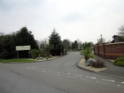
Photo credits for thumbnails on this page (1)
- Nearby: Entrance to Fir Trees Caravan Park, Chester · 0.5 km away: Photo: Jeff Buck, CC BY-SA 2.0, Wikimedia Commons